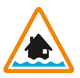


The Aldingbourne Rife is slowly rising, following 15mm of rain early Thursday morning. Minor flood impacts will continue to affect fields near Shripney Lane and the A259, parts of the Tesco car park on Shripney Road and land around caravans at Riverside Caravan Centre. The Barnham Rife is now falling. Minor flood impacts could continue to affect Lake Lane and Barnham Road, Barnham on Thursday. Very little rain is forecast for the rest of Thursday. The Aldingbourne Rife should begin to fall by 17:00 today (02/05/2024), and the Barnham Rife should also return to normal by that time. Scattered showers are possible this weekend and into next week, which could cause river levels to rise a small amount again. Minor flood impacts could remain in Bersted until the start of next week (06/05/2024). Flood protection products are recommended to be kept installed in Barnham, as a precaution, if you have them. We are clearing grilles through Barnham, including at the Trading Post and our pumps at Felpham are running to reduce flood risk. We will update this message by 11:00 on 03/05/2024.
Information supplied by the Environment Agency
This information last updated 10:29am, Thursday 2nd May.
Elbridge, Lidsey, Aldingbourne, Barnham, Yapton and Ryebank Rifes
Region: Solent and South Downs
Country: England
Counties covered: West Sussex
Watercourses covered: Aldingbourne and Barnham Rifes
The area bounded in blue on the map shows the area covered by flood alerts and warnings for Aldingbourne and Barnham Rifes.
Note: the area shown on the map is the area covered by flood alerts and warnings. It is not a live map of current flooding. The area covered broadly equates to the area where the risk of flooding in any year is greater than 1% (the "hundred year" flood risk).

No current or recent warnings.

No current or recent warnings.

No current or recent warnings.

No current or recent warnings.

No current or recent warnings.